Sunday, April 26, 2015

Steve leads publicity hikes for Sun Cruises


We were pleased when Professor Ricardo Trota Jose (Rico) of the University of the Philippines History Department asked to join us for the weekend.  Rico's first trip to Corregidor was in 1977, and his most recent was in the '90s.  Sun Cruises brought video crews to Corregidor on Saturday and Sunday to film us walking along two of our favorite trails.  (Are you getting the idea that every trail on Corregidor is "one of our favorite trails?")  We are hopeful that a video will be put together for the purpose of promoting trail hiking on Corregidor, not only for history buffs, but for avid hikers and nature lovers as well.


Rico, Marcia, and Steve at the mandatory photo stop at Steve's father's gun at Battery Way, before heading into the jungle.

Steve telling Rico about Battery Sunset, which is not far from the trail.

At X-F-1, near Battery Hanna (X-F-2)  Paul of SCI in the foreground, and Photographer Dale at center

Sun Cruises employee Tonie found this old medicine bottle

Rico and Steve at the Battery Hanna overlook

Rico and Steve resting under our favorite banyan tree

Audio specialist Dan exiting Wheeler Tunnel

The first day's photo shoot ended with a tour through the ground floor of a senior officer's duplex

On day 2, the hike began at Kindley Field.  Here are Paul, Julia, Marcia, Steve, Rico, and Tonie, with Caballo Island in the background.

Steve telling Rico about the Japanese landing on May 6, 1942, with photographer Alex in the foreground

Steve and Rico on the very dry Kindley Field, with the video crew looking on

Steve kidded Tonie that she reminded him of the Grim Reaper, with the walking stick that resembles a scythe.  One way to battle the heat here is to wear clothes that breathe and don't allow direct sun to reach the skin.

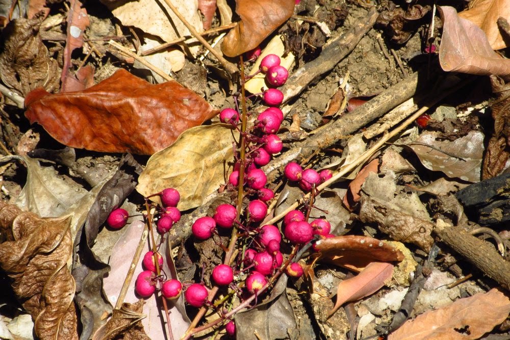
Tonie and Marcia found this large and beautiful blossom, yellow as you can see, with a deep burgundy throat - we'd love to know the name!

When we'd almost reached the eastern tip of the Tail, Marcia took this telephoto view of the towers on Topside, nearly three miles away.

Rico found this shell (ammo) holder far down the tail.  With Julia looking on, Rico explains that it was part of the internal framework for an ammo case, designed to hold the shells in position within the case.  It being made of wood, it's amazing that it hasn't long since ended up in a fisherman's cooking fire.

Videographer Alex in a bird's-eye-view shooting location

Notice that Alex is using a tripod to steady the camera, but against his own torso, not the ground.  We've got to try this!

The grass that was all burned away on our previous visit is starting to grow back.  After rainy season begins, all traces of the fire will soon be gone.

One last look at Hooker Point...the tide level was too high for us to cross the land-bridge today.

And one last look at Caballo Island.  We said the same thing a few weeks ago.  Never say never.

It was hot, and when we finally rounded the tip of the tail (going from the north side to the south side) we found some of the lead walkers had tucked into the shade of a very convenient rock ledge.

After that we returned to Corregidor Bay by banca (small double outrigger) rather than retracing our steps along the same path.  We recommend that Sun Cruises make this an option, which will add to the expense of the hike but offers three big advantages.  The first is that you don't have to return over the same trail, which requires more uphill hiking and can be very tiring when it's as hot as it's been for the past two days.  The second is that the banca ride allows the hikers an up-close view of the north shore of Corregidor, territory that they would otherwise only see at a distance from the ferry.  The third is that less-conditioned and older hikers can participate.

Because it was windy during our return trip, we did not risk taking the camera out and subjecting it to possible saltwater splashes.  Below are a few select photos of the north shore taken on a previous banca ride around the island in September (rainy season) of 2010, so they are not as sunlit as if we had been able to take them today. The terrain is also far greener, for two reasons; the previously mentioned fire has left much of this part of the Tail mostly bare, and what vegetation we encountered today is crispy dry.


 Does anyone else - besides Marcia - see this little rock formation as a person sitting cross-legged and cross-armed, looking right at us?


Love that little tree on the point!  It always reminds us of something from Dr. Seuss.


Same little tree, up close

Malinta Hill center, the "head" of the island (Middleside & Topside) right


We recently hiked both of these trails, and because we were not being videotaped at the time, took many more of our own photos.  If you want to see those earlier stories, they are available at::
and:

We wish to thank Professor Rico Jose for joining us and graciously taking part in the videotaping.  We are very hopeful that both of these trails will soon be a part of Sun Cruises' alternative offerings.

Steve and Marcia on the Rock

Friday, April 24, 2015

Jungle hike to Breakwater Point

On Wednesday, six and a half years to the day from our arrival on Corregidor (Oct. 22, 2008), we hiked one of our favorite jungle trails.  It begins at Battery Ramsey on Middleside, passes near Breakwater Point, and ends at the War Memorial Zone arch at Bottomside.  Come with us - we think you'll like it, too.  To get a "real-feel" for the weather, turn the heat up to 97f (36c) and add lots of humidity.  And, remember to drink plenty of water!

We started at Middleside.  Our house for six years, which we vacated in January, lies just beyond the trees where the road appears to be headed.

The entrance to Battery Ramsey, and the battery itself, is completely overgrown at present.

We've been told that this enormous block of concrete came from the central powder magazine of Battery Geary, which was blown up on May 2, 1942. It appears to be part of the seven-foot-thick roof.

Railroad ties are evident on many of the trails.  The Japanese took the rails as scrap metal, so only a hundred yards or so of the original fourteen miles remain, still evident in the concrete behind our old house, and at Batteries Way and Crockett.

The hike requires a walk by the past and present dump.  Unfortunately, heavy rains send bottles and other trash further down the trail.  An eyesore on an otherwise nice trail walk.

Remnants of a wooden beam lying on the ground, obviously treated wood, and notched for some unknown long-ago building project.

The area on the right (west) of the trail as we descended was once known as the San Pablo Barrio.  There is evidence of many structures throughout the area.

A beautiful tree root

More building remnants

A concrete culvert, evidence that this wasn't always jungle

Rock retaining wall

A branching vine drapes across the trail

Getting down near to the Breakwater Point intersection, we hike along the old army roadbed.  You can see how this road was made by using a machine to cut through the compacted volcanic ash.  Clearly no large bombs landed anywhere near here during the war or the wall would have collapsed.

 Another culvert, as we are now on the road leading to Breakwater Point

Here we are at Breakwater Point, which is actually a ledge, and looking east toward the "Tail."  If you look closely you can see the breakwater in the center of the photo.  It is not directly off the point, as one would assume, but rather to the east.  This is where Japanese Captain (Navy) Itagaki Akira was killed early in the Rock Force Assault on February 16, 1945.

Swinging around toward the south, the tail and Caballo Island (Fort Hughes)

Caballo top left, with Cavite Province center and right

Swinging further right, Batangas Province (upper left)

Looking westward and up the rather steep face of Corregidor's southeast face

Small walls border the edge of the point

Beautiful, clear water on the south (non-Manila) side of the island

Not a swimming beach, though

Telephoto view of the far east end of Corregidor, known both as Hooker Point and Razor Island

Carabao Island (Fort Frank) way off in the distance, just right of dead center

Fort Drum, or what remains of El Fraile Island.  The remains of the two gun turrets can be seen atop the "Concrete Battleship"

Marcia scratching in the dirt looking for a gun mount. 
  Marcia is holding her Ifugao hiking stick, carved from a native vine.  It depicts an open-mouthed snake swallowing a hunting spear.

Marcia has cleared a part of the mount for a small field gun.  Notice the steel rail along the perimeter.

We are now at a siege gun bunker not far northeast of Breakwater Point.  This is the north wall.

The shorter center (east) wall

The south wall

Marcia (and presumably Steve) almost stepped on a bird, which finally flew away from beside Marcia's foot, revealing this (as of yet) unidentified egg on the ground

Marcia got the camera from Steve, sent him away, then hid until the adult returned.  Although this is not the best picture, it's the first one that Marcia has captured of a Philippine Nightjar.  As you can imagine from its name, it's more active at night, when it can be heard to say, loudly, "choo-CHOOO" over and over.  Egg identified!

Here's an interesting seedpod - interior

The same seedpod flipped over - exterior

We encountered many obstacles along the way.  Obviously no one has cleared the trail since the last typhoon, which is a shame, since most of the trails are seldom-explored treasures here.  We know that this particular trail is also a favorite of long-time Corregidor hikers Julia and Jill.

How do you like the appearance of this tree?  It's the only one of its kind that we saw, and are pretty certain that this is the wood just beneath the bark, sculpted by insects that used to live between this wood and the tree's bark.

Through the trees you can catch a glimpse of remnants of the breakwater that lent its name to the point we visited earlier.

A peek at the "tail" and Razor Island as we look through the branches.  At top center is a passing ship headed for Manila.

We found these colorful seeds on the trail.  Any chance they're coffee beans?

This picture doesn't show it well because of the bright sun causing so much contrast, but we're standing on the trail looking up a water runoff (a small ravine, which leads up and slightly to the right). A small tunnel opening can be seen just left of center.

Another of the many culverts along the way.  These were installed about 100 years ago, and keep water from washing out the trails to this day.

A very large piece of concrete, perhaps from Battery Ramsey or Battery Geary, both of which had central magazines destroyed: Ramsey in '45 by the American bombing, and Geary in '42 by Japanese artillery.  Or maybe from somewhere else, who knows?

Another interesting tree root along the way.  The lit up area on the left is part of the same root system but sure looks different, doesn't it?  Notice the "rope vines" looped around the trunk, a very common sight here.  In the foreground are several ligas tree sprouts - those of you who are allergic to poison ivy want to avoid brushing against these leaves, as these cousins can produce the same itchy rash...much to Marcia's dismay.

What caused this tree to assume this shape?  We think that the original trunk broke off at the angle, and the upright "trunk" is actually a branch that began to grow after the tree was already leaning at this angle, perhaps from typhoon winds.

Where the heck did the trail go?  We had anticipated this; it is always difficult to follow the trail right here if no one has cleared it in the recent past.  Thick grass grows in the jungle wherever trees do not block the sun.  In this case, Ramsey Ravine lies to the right.

We've been told that these are a type of fig, although definitely not edible, because the monkeys and birds ignore them.

An old pump house appears up ahead, so we know that we are almost "out of the woods"

Marcia making the final ascent while Steve awaits her at the pump house

A banyan (balete) tree along the road, more magnificent than this photo would seem to suggest

The base of that banyan tree

An old guardrail, but whether it was put in by the Americans before the war, or by the Filipinos afterwards, is beyond our knowledge.  Clearly the pump house is of post-war construction.

Caballo Island off in the distance

The breakwater again, this time with the telephoto, as we have traveled a long way since passing by it

Because it's dry and the road has been cleared since the rainy season ended, it is bare.  But come the rain, it will fill in again, there's no doubt.

An old structure along the road.  We're in the area of what was once Barrio Concepcion, but cannot tell what this would have been.

Hibiscus growth is common in old barrio areas, and in any of the barracks areas

 
A mostly-dry spring right now, as it's been a long, almost rainless, stretch here on the Rock since we returned from the States in early September

A view down to the south dock area

The south beach area.  It always amazes us how dry the island can be and yet how much of the vegetation can remain so brilliantly green.

Our destination.  Now to the showers!

We thank you for joining us on one of our favorite hikes.  You probably didn't work up as much of a sweat as we did, but congratulate yourself.  At least you made it all the way to the end.

Steve and Marcia on the Rock